As part of the implementation of the Company’s Long-Term Corporate Plan (RJPP) 2025–2030, PT Teladan Prima Agro Tbk (TPA) applies a technology-based replanting planning approach as part of a structured crop lifecycle management framework. This initiative is driven by the Company’s plantation age pro...
As part of the implementation of the Company’s Long-Term Corporate Plan (RJPP) 2025–2030, PT Teladan Prima Agro Tbk (TPA) applies a technology-based replanting planning approach as part of a structured crop lifecycle management framework. This initiative is driven by the Company’s plantation age profile, where certain estates from the first-generation planting cycle since the initial planting in 2004 are beginning to enter the mature category. In this context, replanting represents a systematically managed agronomic cycle, incorporating both operational and environmental considerations.
To ensure an integrated and data-driven planning process, the Company plays a central role in developing and managing the overall replanting plan. The approach combines technical methodologies with mapping technologies to deliver improved plantation design outcomes for the next generation.
In developing the replanting landscape, TPA has established four fundamental pillars as its core framework. First, an ergonomic and mechanization-friendly design to enhance long-term operational efficiency. Second, the implementation of soil and water conservation principles to safeguard resource sustainability. Third, comprehensive ecological considerations to maintain biodiversity and environmental balance. Fourth, the use of superior planting materials as the foundation for improved productivity.
These four pillars are translated into practical and implementable plantation landscape designs. To ensure optimal execution, a high level of accuracy and precision is required. Therefore, technology plays a critical role throughout the planning process.
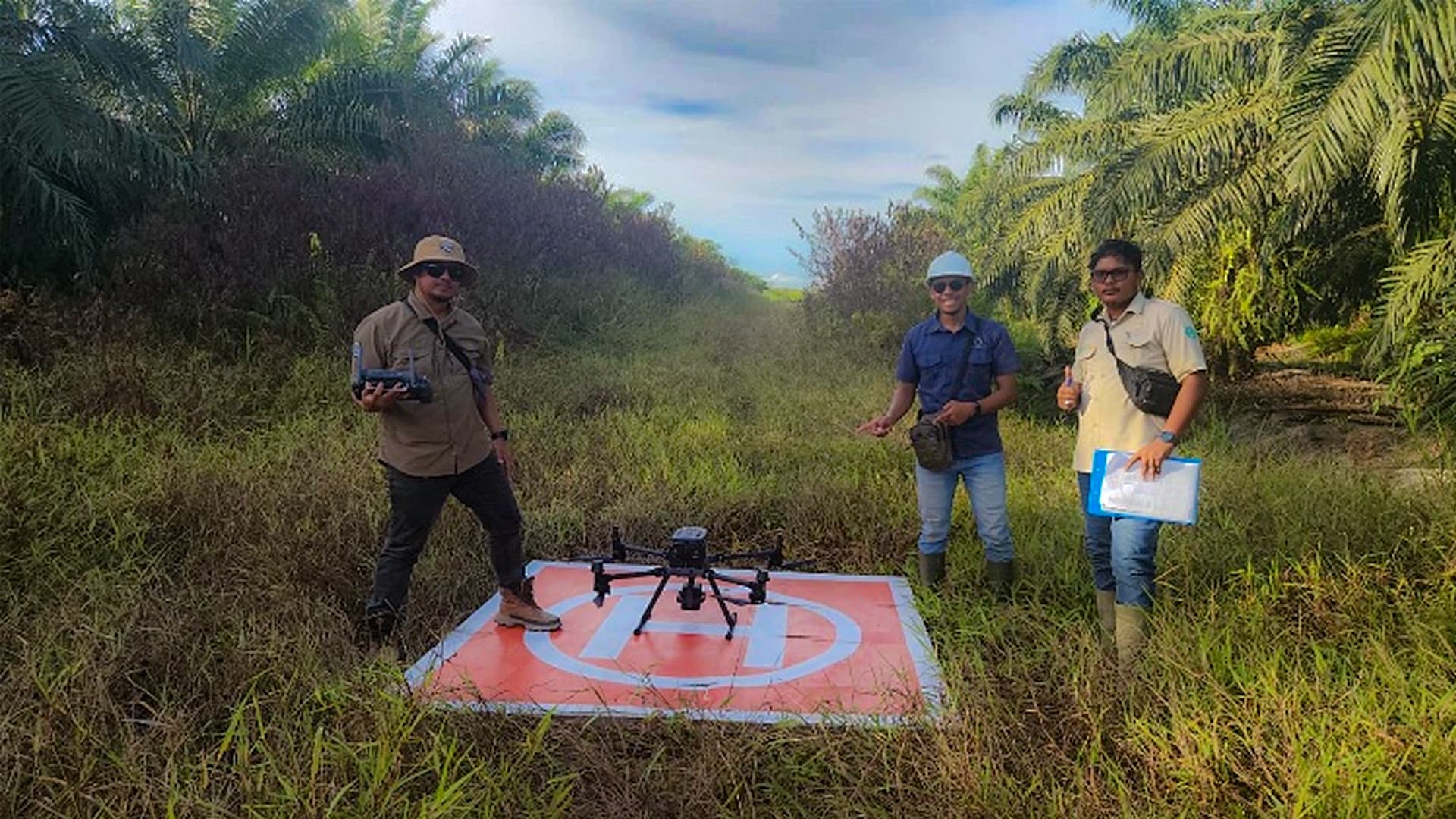
The Company adopts a technology-based approach by integrating drone (Unmanned Aerial Vehicle/UAV) utilization with Geographic Information System (GIS) software for mapping. The methodology includes several key stages: aerial data acquisition, data processing and cleansing to ensure data quality, digital landscape design, field verification, and finalization of the blueprint as the basis for implementation.
The primary output of this approach is a systematically developed replanting design blueprint. This blueprint provides several strategic benefits. First, it enables the Company to generate more accurate estimates of physical work volumes, supporting disciplined capital planning and cost control. Second, the blueprint delivers detailed layout maps covering required infrastructure, including road networks, contour terraces (linked terraces), drainage and water flow systems, as well as bridges and culverts. Third, with clear design guidance, field execution becomes more structured and efficient, while minimizing the risk of deviations from the original plan.
Overall, the Replanting Mapping & Blueprint Design initiative reflects the Company’s commitment to integrating technology into modern agronomic practices. This approach not only strengthens the foundation for long-term productivity but also demonstrates the Company’s discipline in capital expenditure management, cost optimization, and adherence to sustainability principles. Through a data-driven and high-precision approach, the Company aims to establish a second-generation plantation landscape that outperforms the first generation in terms of productivity, efficiency, and sustainability.